Details
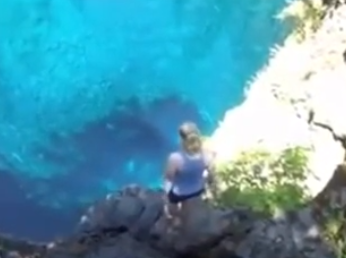
Tamolitch Pool is east of Springfield. This is the actual cyan color of the pool – no camera trick.
The waterfall is invisible. This geologic oddity where water disappears under a lava flow is similar
to Natural Bridge near Diamond Lake.
GPS N44º 18.735?, W122º 01.637? Elevation above sea level 2416ft. Directions: For best optical affect visit on a sunny day. From I-5 exit onto I-105 and head east to Springfield At second light turn left onto Hwy 126 (note milepost numbers increasing as you head east on 126). Few miles past McKenzie Bridge is the junction for Hwy 242 near milepost 54. Continuing on Hwy 126 the milepost numbers do an odd thing –
they restart at milepost 19 and start to decrease. Between milepost 11 and 10 on Hwy 126 turn left at sign for Trail Bridge Campground Short distance on that access road you cross a bridge. Just past that bridge on the right side is a sign for ‘655’ – go down this road for about half a mile. Find a place with room for three cars to park on the left. Trail to Tamolitch Pool starts on the other side of the road -there will be a wooden sign with ‘Tamolitch’ handwritten on it. Follow the sound of the McKenzie River to your right for about 2 miles. There are no facilities. Trail to Tamolitch Pool can also be accessed from Koosah Falls, but it adds an extra 3 miles to the roundtrip.


