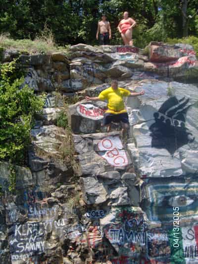
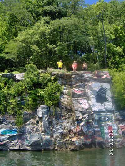
Water Depth
Depth should be treated as unverified until checked in person. Quarry walls can create false confidence if the bottom shelves up or the landing line narrows.

Gilbertsville, Kentucky, United States
ACCESS, BOAT TRAFFIC, AND QUARRY DEPTH ASSUMPTIONS REQUIRE A FRESH CHECK*
Kentucky Lake Rock Quarry appears to be a freshwater quarry cove near Gilbertsville, Kentucky. Treat it as a scout-first location until access, boat traffic, depth, and the exit route are all checked in person.
Quarry walls and clear water can create false confidence. At Kentucky Lake Rock Quarry, the better assumption is that depth and access still need proof every time.
Overview
Kentucky Lake Rock Quarry is a Gilbertsville-area quarry-cove lead on Kentucky Lake. Public sources support the place name and general activity context, but the usable jump line still depends on access, traffic, depth, and same-day water conditions.
Quick Answer
Kentucky Lake Rock Quarry appears to be a freshwater quarry cove near Gilbertsville, Kentucky. Treat it as a scout-first location until access, boat traffic, depth, and the exit route are all checked in person.
Key Takeaway
Quarry walls and clear water can create false confidence. At Kentucky Lake Rock Quarry, the better assumption is that depth and access still need proof every time.
Quick Answer
Kentucky Lake Rock Quarry appears to be a freshwater quarry cove near Gilbertsville, Kentucky. Treat it as a scout-first location until access, boat traffic, depth, and the exit route are all checked in person.
Key Takeaway
Quarry walls and clear water can create false confidence. At Kentucky Lake Rock Quarry, the better assumption is that depth and access still need proof every time.
Conditions and planning notes
Depth should be treated as unverified until checked in person. Quarry walls can create false confidence if the bottom shelves up or the landing line narrows.
Use the Gilbertsville and Kentucky Lake orientation only as a starting point and confirm the public access route before entering shoreline areas that may be private, crowded, or restricted.
Scout the cove slowly enough to see where people are swimming, where boats are moving, and how the exit would work before anyone climbs toward a ledge.
Likely hazards include boat traffic, wakes, hidden shelves, crowding, quarry-wall overconfidence, and unclear or changing access.
Any quarry edge or shoreline ledge here should be treated as variable. Check footing, edge shape, and the exact landing line together.
The biggest risks are access uncertainty, boat traffic, crowding, hidden shelves, and assuming the cove is safer than the conditions actually support.
Map location
Use the source location details as a starting point until exact coordinates are added.
Kentucky Lake Rock Quarry sits near Gilbertsville in a quarry-style freshwater setting tied to Kentucky Lake. The source picture suggests a party-cove feel more than a controlled recreation site, which matters because locations like this often get treated as familiar long after the water, access rules, or shoreline use have changed. The main variables are access and traffic as much as depth. Quarry water can look deep and still hide shelves, walls, or a tighter landing line than expected, and open-water use adds the extra problem of boats, wakes, and people entering the water from several directions. A jump line that looks empty from shore can change quickly once the cove gets busy. Before treating Kentucky Lake Rock Quarry as jumpable, confirm the legal access route, read the cove for boat traffic, inspect the landing zone from the water, and make sure the exit is realistic. If the depth, shoreline footing, or water traffic is unclear, the conservative move is to keep the stop to scouting only.
FAQs
Plan this spot