Details
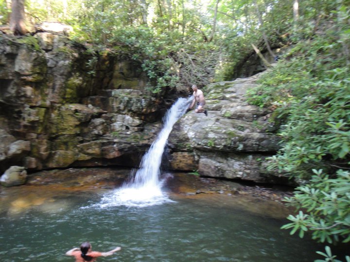
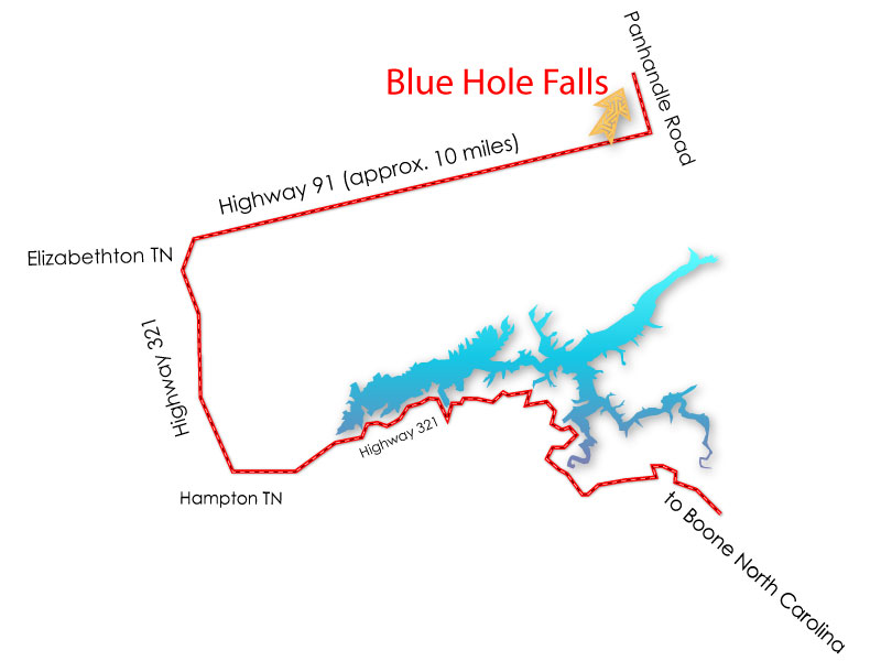
Just northeast of Elizabethton, Tennessee is Holston Mountain. The mountain is in the Cherokee National Forest and is surrounded by South Holston Lake to the northwest, Damascus, Virginia on the northeast and Stony Creek Valley and the Iron Mountains on the south. If you travel about 10 miles northeast of Elizabethton on Route 91 to the Stony Creek Valley (see map below), take a left on Panhandle Road toward Holston Mountain. Just about a mile up on the left you will find a graveled parking area. On the right side of the parking area is a well-marked trail that takes you down along the 4 beautiful waterfalls that make up Blue Hole Falls down to the plunge pool. The hike is not long and the scenery is beautiful.
From Johnson City, TN
1. Head northeast on Ashe St toward Union St 436 ft
2. Take the 1st left onto Buffalo St 0.2 mi
3. Turn right onto E Main St 0.3 mi
4. Turn right to merge onto I-26 E/US-23 S 0.9 mi
5. Take exit 24 for US-321/TN-67 toward Elizabethton 0.2 mi
6. Turn right onto TN-67 E/US-321 N/US-321 Scenic S/University Pkwy Continue to follow US-321 N/US-321 Scenic S 7.6 mi
7. Slight left onto Broad St 1.0 mi
8. Turn left onto TN-37 N/TN-91 N/US-19E N/New Stony Creek Rd/Stony Creek Rd 0.2 mi
9. Exit onto TN-91 N/New Stony Creek Rd toward Stoney Creek/Shady Valley Continue to follow TN-91 N 9.7 mi
10. Turn left onto Mill Creek Rd 0.8 mi
11. Turn left onto National Forest 202/Panhandle Rd 0.2 mi
National Forest 202/Panhandle Rd
Jump Stats
Location
Media
Photos