Details
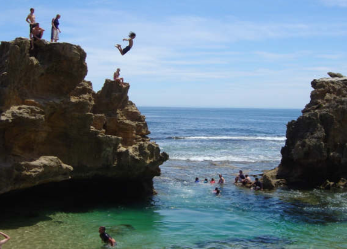
From Melbourne it’s approximately a 1.5 hour drive. Take the Nepean Hwy towards the Mornington Peninsula (this is not the quickest way however is the easiest to describe). For a quicker route refer to the Melways street directory – the cliff is at reference 167 D5. If taking the Nepean Hwy you will pass through Frankston (about 1 hour from Melbourne), Mt Eliza, Mornington and Mt Martha. When nearing the Mornington Peninsula, follow signs with directions to Portsea or Sorrento. When on the Peninsula you will be traveling with Port Phillip Bay on your right and pass through towns such as Rosebud, Tootgarook and Rye (in that order). Then once you hit Blairgowrie, turn left down St Johns Wood Rd (at the Blairgowrie shops). Take this road to the end (about a 3min drive), by which time it will have turned into a dirt road. There’s a small car park at the end. Follow the only track up towards the beach only about 100m. Keep going straight where the path intersects another. Once you reach the top of the hill, take the path to the left. Follow this about 100m to a set of stairs. Go down the stairs then head across the rocks to the far side of Bridgewater Bay where the rock pool will be visible as per the picture. The easiest way up to the top is around to the left of the cliff.
It’s a great place for beginners, or to just chill at the beach or swim in the pool. In hot summer days you’ll get a big crowd.
Jump Stats
Location
Media
Photos